Showing posts with label Beautiful Places In The World. Show all posts

Milford sound and the Mitre peak

Monday, June 6, 2011

0 comments
Milford sound and the Mitre peak
country : New Zealand
place : south-west of the southern island


Fill a tumbler full of water from a waterfall cascading from rocks hundreds of metres above your head on a scenic cruise of the Milford Sound and you will know what it really means to be a New Zealander. Taste its pure flavour and you'll know you're in the Milford Sound.
The scale of the landscape in Milford Sound is phenomenal. Large cruise boats look extremely insignificant against the grandeur of Mitre Peak and the walls of this mighty fiord. Its steep rock walls plunge vertically for hundreds of metres both above and below the water line, allowing cruise boats to maneuver beneath the falls.
In 1986, UNESCO bestowed World Heritage status to this region in recognition of its "superlative natural phenomena" and "outstanding examples of the earth's evolutionary history."

This description is not lost on international visitors who flock here from all over the world. Neither is it lost on locals, no matter how often they have visited.

There�s a wide array of cruises on offer in Milford � ranging from scenic cruises and extended daytime cruises with a nature guide, through to overnight excursions with the option of exploring by kayak or tender craft.
However, Milford Sound is not only remarkable above the water, it also has a unique marine environment.
This underwater world is most easily viewed from the Underwater Observatory. It features a spiral staircase that descends for more than seven metres under the water surface to an observation deck.

The deck is fitted with windows to view rare marine life such as Black Coral, which occurs much closer to the surface than deemed normal, thanks to a layer of fresh tannin water which filters light.
For those who wish to get right amongst it, there's also the option to take a guided dive, or explore the grandeur of this magnificent sound by kayak.

The scenic icon of New Zealand is the picture-perfect view of Mitre Peak mirrored in the glassy waters of Milford Sound.

Milford Sound�s majestic grandeur is symbolised by the perfection of this scene of sheer rock walls, 1700 metres high, plummeting into the black depths of the fiord. No wonder author Rudyard Kipling described Milford as the eight wonder of the world, and Arthur Michener thought of it as �the most stirring sight in the Pacific�.

The majestic scenery begins long before you reach Milford, in the Eglinton Valley. Snow-capped mountains loom 1000 metres above the road, streaked with waterfalls, and reflected in mirror lakes. The road climbs steeply into a sub-alpine wonderland at the Homer Tunnel entrance. You emerge from the tunnel to an instantly breathtaking view of the canyon which descends into Milford.

Milford Sound comes a close second to the mountains of Tahiti in recording the highest rainfall in the world. The deluge of 7 metres of rain each year sounds forbidding for a tourist resort, but it actually adds to the drama and mystique of the sound. In torrential rain the sheer mountain walls erupt with a thousand cascades plunging from hanging valleys, wreathed in ethereal mists, and crossed with rainbows.

A boat cruise is the best way to appreciate the grandeur of the sound. Highlights include Bowen Falls, Mitre Peak, Anita Bay, The Elephant and Stirling Falls. In Harrison Cove there is an underwater observatory with views of aquatic life on the reef. Some cruises go out to the entrance of the Sound where dolphins, fur seals and crested penguins may be seen.
Kayaking and diving trips can be arranged and divers have the rare opportunity of seeing black coral at relatively shallow depths. Scenic flights take in the other main sounds down the coast, and the Sutherland Falls, which are New Zealand�s highest.

The 55 km Milford Track, reputed to be �The Finest Walk in the World� operates in the summer months. It takes three days and links Lake Te Anau with Milford Sound.
Milford Sound provides a rare chance to get a close view of nature on a grand scale. It�s the ultimate in scenic splendour in a country that excels in mountain grandeur.


Free Template Blogger collection template Hot Deals BERITA_wongANteng SEO theproperty-developer

The Big cliff Preikestolen

Sunday, May 29, 2011

0 comments
The Big cliff  Preikestolen
country : Norway
place : west of the country


Preikestolen is a massive cliff in Norway that towers 604 meters (1982 feet) in near vertical drop over the ocean. When famous French writer Victor Hugo visited the fjords, he referred to them as �the most terrifying of the ocean reefs.� Preikestolen is a natural rock formation that was carved by melting glaciers at the end of the Ice Age. The 25 square meters plateau on top of Preikestolen Pulpit Rock offers breathtaking views of the fjord and creates terrific photo opportunities. You have quite likely seen pictures of people standing on top of Preikestolen Pulpit Rock before and found them suspensfully bewildering. You probably didn�t have them associate with the name of the place, but now you know. The most spine-tingling cliff overlooking the magnificent ocean fjord is called Preikestolen and you can find it in Norway. Thanks to its near straight vertical properties, Preikestolen is popular with BASE jumpers. BASE jumping is legal in Lysefjorden area but as it goes with extreme sports, some BASE jumpers jumped to their deaths here.

Preikestolen Location
Preikestolen Pulpit Rock is located in south-western Norway, in Forsand municipality of Rogaland county, on the edge of 42 km long ocean fjord called Lysefjorden. Kjerag Mountain, which are a home to another famous natural attraction in Norway � Kjeragbolten, a boulder wedged between two vertical cliffs is located at the end of Lysefjord, opposite of Preikestolen.

How to Get to Preikestolen
Most travellers who visit Preikestolen start their tour in Stavanger � closest major town to Preikestolen in south-west Norway. Ferries leave Stavanger three times a day and will deliver you to small town called Tau in about 40 minutes. The cost for a boat ride is 50 Norwegian Krone. Bus service and taxis are synchronized with the ferries and will take you to the parking lot where trekking route leading up to Preikestolen begins for 65 Norwegian Krone. From there you are on your own.

The hike up the hill will take between 1 hour to 3 hours, depending on your fitness level. The total length of the trail from the parking lot below up on top of Preikestolen is 3.8 km (2.4 miles) which is not that long � on flat terrain, an average trekker could cover such distance in less than an hour. The elevation difference between the parking lot and Preikestolen is only 334 metres (1096 feet). This should not cause any issues to most hikers, however do keep in mind that vertical sickness can affect anyone, especially those who come from coastal areas or spent a long time close to the sea. Have enough water on you to avoid dehydration and pack in something to eat as well. Most of all, make sure you�re wearing proper trekking shoes with hard soles as terrain is rather uneven and you will often walk on rocks with sharp edges.

The entire hike is very scenic so you will be getting rewards for your uphill walk with each step. It gets especially magnificent as you start approaching the top and the first glimpses of Lysefjord from high elevation come to sight. Once you have reached the top of Preikestolen, make sure you carefully approach the edge of the plateau and lay down on it so you can look straight down into the abyss below. more than 600 meters long drop will take your breath away and an adrenaline rush will evoke feelings you won�t easily forget.
Preikestolen Accommodation Options
You have several accommodation options if you wish to stay close to Preikestolen. Pulpit Rock Lodge is located on Rv 13, the main road that goes through the area. Recently rebuilt youth hostel Preikestolen Fjellstue is located in the Ryfylke hills, close to Refsvatn Lake. Aside from stunning scenery and proximity to Pulpit Rock, Preikestolen Fjellstue also offers great fishing opportunities and has several associated camping grounds for backpackers with tents.

Other Names of Preikestolen
The name Preikestolen is sometimes misspelled as Prekestolen. Translated from Norwegian to English, Preikestolen means Pulpit Rock but is sometimes referred to as Preacher�s Pulpit. Before it was named Preikestolen, the Pulpit Rock was known by its original name Hyvlatonn?, which means �the tooth of a woodplane�
Preikestolen BASE Jumping
If climbing Pulpit Rock and looking over its edge is not enough of a challenge for you and you�d like to engage in something that pumps more adrenaline through your veins, then you may want to consider Preikestolen BASE Jumping. However given that BASE jumping is one of the riskiest adrenaline sports in existence, make sure you have sufficient experience and understand potential risks.

Preikestolen Deaths and Accidents
In past 15 years, there have been more than 30,000 BASE jumps performed in Preikestolen and Kjerag Mountain area. Out of 30,000, only 9 people found their death on the steep cliffs around Lysefjord. While one death or accident is too many, the statistics clearly suggest that BASE jumping enthusiasts know what they are doing and are able to enjoy the rush safely. 9 deaths in 30,000 BASE jumps � you find more deaths in other popular tourist activities than here.

Lysefjord Cruise
If climbing up the hike to Preikestolen is not an option for you, due to health concerns, you may opt for Lysefjord Cruise. It�s a completely different adventure with different experience. The ship will take you for a cruise up and down the Lysefjord offering the view of Preikestolen from different perspective. Seeing this majestic vertical cliff from the ocean below is as breath taking as seeing the fjord from up there. Lysefjord Cruises are offered by Rodne Fjord Cruise company and cost 350 Norwegian Krone.


Free Template Blogger collection template Hot Deals BERITA_wongANteng SEO theproperty-developer

Venice and its canals

Thursday, May 26, 2011

0 comments
Venice and its canals
country : Italia
place : Venice


The beautiful Venice is surrounded by water all over and is located on the north of Italy. The capital of Venice is Veneto. It is commonly known as the city of lovers, water and also the city of bridges. It is spread over 118 Islands, not very big in size. Venice is very famous in the worlds because of its canals. The city has in total 150 canals and the most important canal in Venice is called the Grand Canal. It is responsible for managing the traffic in water by corridor management. Instead of visiting any place by transportation means of roads or air, it is very common to find water buses and water taxi. It seems that the people here live in a different land and world altogether, During the day time, the city is very much crowded with visitors all across the world trying to experience love and romance in the city. Narrow yet beautiful canals, bridges streets give a very different feel of the place. Anyone who visits this place immediately falls in love with it. The nights on the other hand are quiet and peaceful.


Motor boats are not allowed to travel in small canals that are narrow, windy and lead to the old city. The city has almost 400 bridges and the Grand Canal cuts the city equally into two proportionate halves from the north to the south. The total length of the Grand Canal is three kilometers. One of the constant threat that the city is experiencing is the air, wind and water pollution over and above the natural disaster like the flood and weakening infrastructure of the building.


Free Template Blogger collection template Hot Deals BERITA_wongANteng SEO theproperty-developer

The caves of Carlsbad

0 comments
The caves of Carlsbad
country : United States of America
place : New Mexico State


The Guadalupe Mountains span the Texas/New Mexico border and rise to heights of 8,749 feet, in great contrast to the flat Chihuahuan Desert land all around. Two national parks are found within their range; Guadalupe Mountains (in Texas), which features rocky peaks and scenic valleys with varied wildlife, and Carlsbad Caverns, one of the oldest and most famous cave systems in the world. The caverns are a full day's drive from any of the other major attractions in the Southwest, but are well worth the long journey - they include several vast underground chambers, up to 250 feet high, filled with amazing formations of many colors and shapes.
Approaches: A long straight road is a common feature of the Southwest, and the caverns are reached by one such route; US 62/180 that links Carlsbad with El Paso.


The western stretches in Texas pass 100 miles of salt flats, sandy wasteland and grassy prairie before the forested Guadalupe Mountains come slowly into view, then, after a steeper and more winding section, the highway straightens out again, crossing more desert flats towards Carlsbad. The turn-off to the national park is marked by a collection of Western-style souvenir shops, restaurants and lodgings, known as White's City, including the last gas station for 130 miles westwards. From here a rather narrow and winding side road climbs for 7 miles through a shallow limestone gorge (Walnut Canyon) that has attractive rocky scenery with particularly abundant Chihuahuan Desert plants such as agaves and opuntia cacti. There is no campground in the park, and the only official site nearby is the rather pricy establishment at White's City, though free primitive camping is possible along several dirt tracks heading east from US 62/180, a few miles south of the park junction.


Map: Map of Carlsbad Caverns National Park.


Carlsbad Caverns Hotels: Apart from White's City which has a motel, the nearest place with hotels close to Carlsbad Caverns National Park is Carlsbad, 27 miles northeast of the cave entrance.


Features: The entrance to Carlsbad Cavern is on the plateau at the south side of Walnut Canyon, where a huge visitor complex has been constructed, with acres of parking and a network of service roads. Inside the main building are a museum, book store, auditorium, cafe, cinema-style counter for purchase of tour tickets, and elevators that provide a short cut into the caverns below. The fee to enter the caves is $6 per person (unchanged for many years), although entrance to the park is free. Other attractions in this section of the national park include the 9.5 mile, one-way Desert Loop Drive (no vehicles over 20 feet allowed) that continues westwards along the plateau top then returns via upper Walnut Canyon, and the one mile Chihuahuan Desert Nature Trail through similar scenery close to the cave entrance, while elsewhere in the park are several longer hiking trails and many secret backcountry caves, a few of which are open to the public, but of course almost all visitors come only for the trips underground in the main cavern.


The Cavern: The usual way to see the formations of Carlsbad Cavern is by one or both of two self-guiding walking tours - Big Room or Natural Entrance - which visit different parts of the chambers. Four other branches of the cave may be explored by ranger-led hikes, for an extra fee (Kings Palace, Left Hand Tunnel, Lower Cave and Hall of the White Giant)


Big Room - for this, the less strenuous option, visitors descend 754 feet over one minute in an elevator that starts from inside the visitor center to be greeted, rather incongruously, by a rest-area and lunch room, but a short walk along a wide passage leads to the main cave area - the Big Room, 3,800 feet long and 600 feet wide, where most of the largest formations are found. The 1.25 mile path follows a roughly circular (anti-clockwise) route down one side of the chambers and back along the other, and the cave is so large that the two parts of the trail are generally out of sight of each other. Around 20 of the most spectacular speleotherms have an official name - grandiose appellations such as Hall of the Giants, Temple of the Sun and Rock of Ages, and are subtly lit with electric lights to create a most enchanting spectacle; the lights are white, so all colors in the caves are natural. Some areas have shallow underground pools, also illuminated, whose reflections add another dimension to the delicate formations above. Rangers are stationed at frequent intervals to answer questions, and the tours are usually very busy, so this is hardly a wilderness experience, but still one of the highlights of the Southwest. Along the main trail are many closed gates guarding small paths leading to unseen passages, and there are frequent glimpses downwards to deeper levels, some not easily explorable including the Bottomless Pit, 370 feet deep. Most parts of the Big Room route are wheelchair-accessible, and all have a special non-slip surface.


Natural Entrance - a gentle walk across the cactus desert leads to a huge opening in the plateau, where the path zig-zags down into the darkness below. This chasm is the place of egress for a colony of up to 300,000 Mexican free-tail bats that live in one of the branches of the cave below from April to September, and it is a memorable event at sunset to watch the colony emerge, which takes up to half an hour. The bats spend winter in the warmer lands of Mexico. An amphitheater has been constructed at the entrance, and organised evening sittings are provided in season (no photography permitted). Underground, the path is quite steep at first as it drops 750 feet, into a large, dimly-lit chamber that is initially devoid of formations. This passageway continues eastwards into the bat residence, but the path turns back west, descending again, gently at first then more steeply, into narrower tunnels where the first extensive collections of stalagmites and stalactites are found, including such named features as Devils Spring, Queen's Chamber, Kings Palace and the Boneyard. The surroundings become steadily more scenic, with small side-caves filled with intricate rock forms, before the path arrives at the elevator to the surface visitor center, and links with the Big Room route as above.
Kings Palace - four separate chambers accessed from a cave near the elevator. This is the deepest part of Carlsbad Cavern currently open to the public, 830 feet in one section, and may be visited as part of a ranger-led tour that lasts 90 minutes and is provided five times each day, between Memorial Day and Labor Day. Highlights include the Queens Draperies, a particularly large series of rippled sheet formations.


Left Hand Tunnel - lantern-lit passageways featuring fossils, cave pools and delicate speleotherms. The tour is held once each day and lasts about 2 hours.
Lower Cave - a vast lower level, branching off the Big Room about half way along the loop, filled with equally spectacular features as the main chamber. Accessed by metal ladders, and visited on a 3 hour tour starting 1 pm, Monday through Friday.


Hall of the White Giant - a more remote section of the cavern, containing a huge white stalagmite. The tour requires crawling through narrow passages and climbing metal ladders, costs $20 per person, lasts 4 hours, and is scheduled only once a week (on Saturdays).
Other Activities: Details of other areas of the park, including hiking trails and backcountry caves.


Source: http://www.americansouthwest.net


Free Template Blogger collection template Hot Deals BERITA_wongANteng SEO theproperty-developer

The Perito Moreno glacier

Tuesday, May 24, 2011

1 comments
The Perito Moreno glacier
country : Argentina
place : Patagonia

The fracture of Perito Moreno Glacier
A phenomenon that was already becoming one of the Patagonian myths and that most people thought would never take place again has just happened: since October 2003 the glacier�s ice wall started moving towards the shore, closing the flow of the water that drains through Brazo Rico to Canal de los T�mpanos. This was the first step of the process, which resulted in the glacier fracture.

Finally, after a great deal of expectation and in front of over 17 thousand mesmerized tourists from all over the world, the Perito Moreno Glacier fell apart during a process that started thursday March 11th. and ended on sunday March 14th, at 7.09 PM, when the ice giant could no longer keep resisting the slow but unstoppable flow of water underneath.

What is the process like ?

Lake Argentino, in which Perito Moreno Glacier is set, has many branches. Two of them, Sur and Rico, are behind the Magellan�s Peninsula and they debouch in the lake through the T�mpanos Channel. And from time to time the glacier's front ice tongue moves forward and joins the Peninsula, even climbing its coasts. This amazing natural dam makes the level of the Sur and Rico branches (which still keep getting water, ice and snow), raise their level causing a huge amount of pressure. This pressure eases when the water starts filtering through the places where the glacier touches ground and it digs a sort of tunnel underneath the ice.

Finally, when this hole gets too big and due to the water pressure, the enormous wall of ice falls apart causing one of the most overwhelming natural phenomenon that can be seen. The fracture of the glacier may last two or three full days. In this case, it was four days of an endless show of huge pieces of ice detaching from the glacier, until the final moment when it all fell apart.

A little history
In order to better understand the fracture that has made Perito Moreno Glacier so famous around the world it is good to review the facts we know about the history of this unmatchable event.

The first fracture registered occurred in 1917. After that, during the 20th century the phenomenon occurred 16 times, the last one being February 17th, 1988. As years passed, and given the fact that most glaciers in the world are in withdrawal, people thought that the Perito Moreno wouldn't close over the Magallanes Peninsula any more.

But nature surprises us again.

It is important to remember that this time, like every other the glacier fractured in the past, the water level difference between the branches and the lake has to be very important: from 16 to 30 meters. From the south catwalk, the show was imposing; it could be seen from a distance of only 30 ft. and even feel the cold it generated in one's skin.

Experts say that this kind of phenomenon is impossible to predict, reason for which we must feel very lucky for having been able to witness such an event and for having one glacier that is still going strong despite the global heating: the Perito Moreno Glacier.

Perito Moreno Glacier
This is the most spectacular and unforgettable excursion in all Patagonia.
At the beginning of the tour, you will skirt Bay Redonda of Lake Argentino as well as have the chance to see Isla Solitaire.
You will go through the Patagonia valley with its natural environment of species such as guanacos, ostriches, foxes, etc.
Afterwards you will enjoy many interesting spots: Cerro Comision o De Los Elefantes, river Centinela, Cerro Frias (guanacos site), many Patagonian farmhouses and, across the Mitre river you will get into National Park Los Glaciares.


Then, you will go 35 km along the coast of of Lake Argentino's Rico Branch, among vegetation of incredible trees such as ?ires, lengas, notros and cherry trees.
At Curva de Los Suspiros you will get the first panoramic view of Glacier Perito Moreno.

An ice cloak, or glacial cap, covers this Protected Area of 600,000 hectares. Among the 356 glaciers, the Perito Moreno is the most outstanding one, having a front of 5 km long and a height of over 60 meters above the level of the water.

Known worldwide because of its process of fractures, the front of the glacier closes the running of the waters of Brazo Rico when it approaches the coast. This produces a kind of pond where the water goes up 20 meters over the level, creating the filtration that ends up in the fracture; the last time was in March 2004.

But show is never-ending. You can watch the detachment of ice blocks of different sizes from a short distance, hear the roaring they produce, and then watch them turned into wonderful floating icebergs.

Walking on the glaciers (see Minitrekking) or going along Lake Argentino to see the front of the other Glacier, Upsala, (see Estancia Cristina, ex Upsala Explorer) is an unique experience.

In 1981 UNESCO declared National Park Los Glaciares a World Heritage Site.
It is an unforgettable experience.But there's more: If you wish to obtain alternative views of this ice giant, from the Bajo de Las Sombras pier (8 km from the watching spot) you can hire the service called "Sailing Safari" that consists of sailing for about half an hour in front of the south wall of Perito Moreno Glacier. This add-on excursion is the only way to get to see this part of the majestic Glacier.

If you opt for not to take this extension, then the Tourist minivan will take you up to the restaurant that is right beside the catwalks. However, if you wish to spend less for your lunch, there is also a snack bar where you can have a hot soup, sandwiches, cakes and beverages.The Perito Moreno Glaciernear Calafate
Just far enough from the bounds of civilization and urban dwelling, veiled by towering mountains and an expansive lake, the Perito Moreno Glacier epitomizes the natural beauty and splendor of Argentina. Unique in a variety of facets, including its size, scientific significance, and accessibility, the glacier is an essential stop for any traveler to the region. Visitors spend hours exploring its wonders and taking in its breathtaking vistas, barely believing their eyes as they gaze upon the picturesque sight which lies before them.

At first sight, you will be taken aback by the sheer magnitude of Perito Moreno, one of the largest glaciers in both Glaciers National Park and South America. Its walls tower over two-hundred vertical feet (forty meters) from the ground, where the ice meets the Lago Argentino, or Lake Argentina. At this height, equivalent to that of a fifteen-story building, the glacier maintains a commanding presence for approximately five kilometers of horizontal distance. At times the glacier will form an imposing panoramic wall, stretching as far as the eye can see in either direction. This undeniable physical beauty is only amplified when one learns of the scientific significance that the formation brings to Patagonia.

The most notable feature about the Perito Moreno Glacier is its dynamic and ever-changing facade. Unlike nearly every other glacier on the planet, which recede and dwindle in size over time, the Peritio Moreno formation actually swells with each passing day. Deemed an "advancing glacier," the ice is continually growing and expanding outward, gradually occupying more and more territory. 

While the glacier is said to move outward at a pace of up to seven feet each day, large chunks of ice falling from the walls make this growth a bit more subtle. This phenomenon also makes viewing the glacier all the more unpredictable and exciting.

There are many ways to experience the Perito Moreno Glacier, including Glacier Trekking and Viewing Cruises. Regardless of the option you choose, however, you'll never forget the time you spend exploring this one of a kind South American wonder.

Glacier Trekking
Glacier trekking is the most first-hand way to experience the Perito Moreno formation. By mini-trekking across the icy surface, you'll feel the chill of Patagonia, hear the roar of falling ice blocks, and see beautiful vistas of Lake Argentina. This is typically a half-day tour, including a brief walk through the glacial forests, and introductory discussion on glaciology, and an hour long hike on the glacier itself. Because of the complex nature of the Perito Moreno Glacier, only guided tours are allowed to trek on the ice. Thus, travelers should remember to book their mini-trekking excursion in advance. Unfortunately, children under eight years of age are not permitted on the glacier trek.

Glacier Viewing Cruises
There are a number of boat excursions that allow visitors to observe the vastness of the Perito Moreno Glacier without actually setting foot on the ice's surface. While the boat will likely maintain a safe distance from the glacial walls, you'll still experience the exhilarating feel of rocky waters caused by the icy debris falling from the glacier. Atop a turquoise sea of chilly waters spotted with countless icebergs, your journey can last anywhere from a single hour to an entire day.

Accessing the Glacier
The Perito Moreno Glacier is located with the Los Glaciers National Park, on the shore of Lago Argentino about an hour and a half drive from El Calafate. Shuttles departing from the town of El Calafate provide the most convenient access to glacial tours, which depart at several times throughout the day. Visitiors are encouraged to leave early, however, to ensure ample time to explore the magnificence of Perito Moreno.


Free Template Blogger collection template Hot Deals BERITA_wongANteng SEO theproperty-developer

The salar of Uyuni

Wednesday, May 18, 2011

0 comments
The salar of Uyuni
country : Bolivia
place : south-west of the country

Your exploration will begin at the town of Uyuni, that seats on the edge of the salt desert near the border with Chile, at an altitude of 3,670 m. (12,040 f.) above sea level.
A four-day tour will cost you around U$D 100, plus park's entrance fee and tips to the guide.
You are better off by carrying some cash with you, small denominatons either Bolivars if Dollars and, of course, your camera gear by all means.
And talking about photography, see how both Bolivia and Chile look like from Space at South America through Astronaut Photography.
Salar de Uyuni has an average annual temperature between 20 degrees Celsius and -25 C. in winter.
From July to November the salt bed is very dry while in summer (November to March), being the rainy season, you might find it inundated, which makes the whole experience even more surreal.
A very unique South America vacation...

Antarctica might look somewhat like this at a glance, but it doesn't have the sheer flatness over an area of 10,000 square kilometers. Perhaps, then, it's more like an extraterrestrial planet with no people � just a windswept, briny atmosphere, thin in oxygen because of its height. But no � this vast expanse is right here on earth in one of our South American countries, Bolivia. It is Salar de Uyuni, the largest salt flats � and one of the most amazing sights � in the world.

Millennia ago, about 30,000 years or a little more, there was one big lake, Lake Minchin. It changed through different geological processes and ended up as two freshwater lakes and two saltwater lakes, one of those being Uyuni.

As time went by, Uyuni developed a thick salt crust of brine on top composed of lithium, magnesium and table salt.

Today, the salt is scraped up from the sheer flat surface of the flats into piles where it dries better and is easier to cart away. Some of the crust goes down meters into the brine; in other places it is just a few inches, as you can see below.

Half of the world's lithium in to be found in the brine under Uyuni's salt flats; this is extracted for use in batteries and medicines. Tourism is also one of Bolivia's biggest sources of income, and the salt flats are a must stop for most. Tourists get to stay in salt hotels: the first one built closed in 2002 because a few environmental regulations were forgotten � like what to do with waste materials � but others have been opened closer to the edge of the flats where there are roads to cart off the waste. Big blocks of salt became the bedrock of the hotels as this was the most readily available building material around. Below the man is cutting the blocks for construction.

There are also several lakes in the area that flood during the rainy season, sending cascades of water to cover Salar de Uyuni.

When it is covered in a sheet of water it becomes the largest mirror in the world.

Not only does the Salar provide salt, lithium, halide and gypsum, the proceeds of which the locals who pile it up get to divvy up as part of their cooperative; no, astronauts use the flats as well! It is one of the highest and largest flats on earth, and is smoothed from flooding every season � dissolving bumps and interference � so is ideal to use for calibrating the location of satellites.

The sun slowly sets on the flats, the golden colors shimmering back from the ground, making the whole lake look like it has turned into a fairies' party ground with fairy lights everywhere. It is a remarkable sight that is seen nowhere else in the world, nor probably in the universe.

Salar de Uyuni Attractions:
Isla de los Pescadores (Inca Huasi): Amazing place full of giant cacti that rises 150 meters above the surface of the salt lake.It also has archaeological remains from the Tiwuanaku and Inca civilizations.
Isla C?scara de Huevo (Eggshell island)
Tunupa and Jiriri volcanoes
Laguna Colorada (Red laggon)
Laguna Verde (Green Lagoon)
Hotel de Sal (Salt hotel). Almost entirely built with salt, including furniture.

Salar de Uyuni is a fantasy world of its own you shouldn't miss.
As much as no tour to Peru would be complete without a visit to Cuzco and Machu Picchu, your Bolivia travel experience should include a visit to Salar de Uyuni, one of the greatest natural wonders in the heart of South America.


How to Get There:
By Air:
From Cochabamba (Bolivia) there are a couple of weekly flights with L?neas Aereas Canedo- around U$250 return. Check before as the Uyuni air strip was under remodeling last year.

Update (04-2011): The new airstrip is operational, with a length of 4km. According to the Bolivian government, Uyuni Airport will turn international by 2012.

By Bus:
From La Paz: around 12 hours ride.
From Potosi: 7 hours.
From Oruro: 4 hours.
There are also buses from San Pedro de Atacama, Chile.

By Train:
Uyuni town is an important transport hub in the region and several lines cross it.
If coming from Argentina, take a train at Villazon, border with Bolivia. Around four times a week at the price of U$D8.00.
There is also a train connection from/to Calama, Chile.

Where to Stay:
Tonito Hotel: Ferroviaria 60, Uyuni. ph. 591 2 (693 3186)
Hotel Julia: Corner of Ferroviario and Arce, Uyuni
Hotel Avenida: Ferroviaria 11, Uyuni. ph. 693-2078
Hostal Sajama: Potos? 35, Uyuni. ph. 693-3099


Source: http://www.unique-southamerica-travel-experience.com, http://www.environmentalgraffiti.com


Free Template Blogger collection template Hot Deals BERITA_wongANteng SEO theproperty-developer

The Niagara waterfalls

0 comments
The Niagara waterfalls
country : Canada � United States of America
place : Niagara, near Toronto

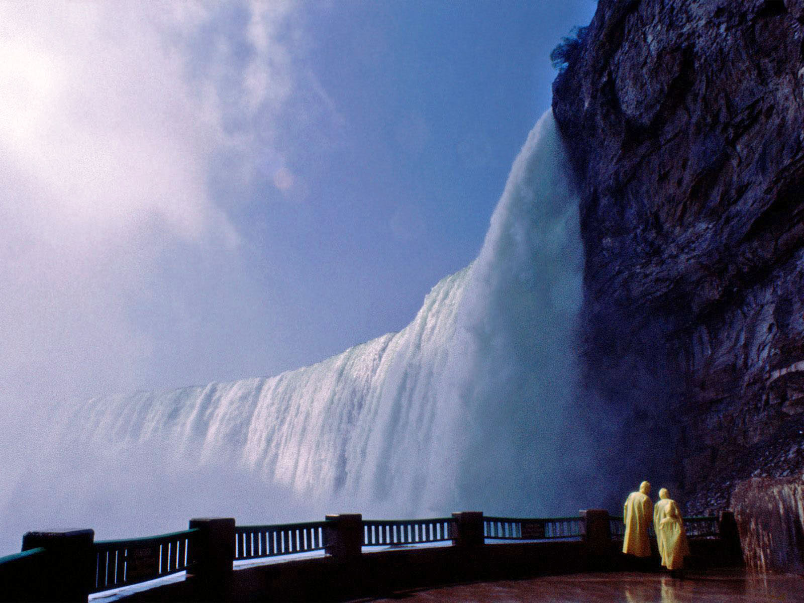
Niagara Falls, cataract on the Niagara River in northeastern North America, one of the continent�s most famous spectacles. The falls lie on the border between Ontario, Can., and New York state, U.S. For many decades the falls were an attraction for honeymooners and for such stunts as walking over the falls on a tightrope or going over them in a barrel. Increasingly, however, the appeal of the site has become its beauty and uniqueness as a physical phenomenon.
The falls are in two principal parts, separated by Goat Island. The larger division, adjoining the left, or Canadian, bank, is Horseshoe Falls; its height is 185 feet (56 metres), and the length of its curving crest line is about 2,200 feet (670 metres). The American Falls, adjoining the right bank, are 190 feet (58 metres) high and 1,060 feet (320 metres) across.
The formation of the Niagara gorge (downriver) and the maintenance of the falls as a cataract depend upon peculiar geologic conditions. The rock strata from the Silurian Period (about 445 to 415 million years ago) in the Niagara gorge are nearly horizontal, dipping southward only about 20 feet per mile (almost 4 metres per km). An upper layer of hard dolomite is underlain by softer layers of shale. Water exerts hydrostatic pressure and only slowly dissolves the dolomite after infiltrating its joints. Dolomite blocks fall away as water from above infiltrates and rapidly erodes the shale at the falls itself. The disposition of the rock strata provides the conditions for keeping the water constantly falling vertically from an overhanging ledge during a long period of recession (movement upstream) of the cataract. As blocks of dolomite are undercut they fall off and are rapidly destroyed by the falling water, further facilitating the retreat of the falls and the maintenance of a vertical cataract.
The water flowing over the falls is free of sediment, and its clearness contributes to the beauty of the cataract. In recognition of the importance of the waterfall as a great natural spectacle, the province of Ontario and the state of New York retained or acquired title to the adjacent lands and converted them into public parks.

In recent years the very large diversion of water above the falls for hydroelectric-power purposes has lessened the rate of erosion. Elaborate control works upstream from the falls have
maintained an even distribution of flow across both the U.S. and Canadian cataracts, thereby preserving the curtains of the waterfalls. A large part of the great river above the falls is diverted and disappears into four great tunnels for use in the power plants downstream. Owing to concern over the possibility of major rockfalls, water was diverted from the American Falls in 1969, and some cementing of the bedrock was done; an extensive boring and sampling program was also carried out. River flow was returned to the American Falls in November of that year, and it was decided that safety measures for the viewing public should be implemented and that measures to stem natural processes were both too expensive and undesirable.

Excellent views of the falls are obtained from Queen Victoria Park on the Canadian side; from Prospect Point of the U.S. side at the edge of the American Falls; and from Rainbow Bridge, which spans the Niagara gorge about 1,000 feet (300 metres) downstream from Prospect Point. Visitors may cross from the U.S. shore to Goat Island by footbridge and may take an elevator to the foot of the falls and visit the Cave of the Winds behind the curtain of falling water. The Horseshoe Falls, which carry about 90 percent of the river�s discharge, receded upstream at an average rate of about 5.5 feet (1.7 metres) per year in 1842�1905. Thereafter, control works and the diversion of water decreased the erosion rate, which is presently so slow at the American Falls that large blocks of dolomite accumulate at the base of the falls, threatening to turn it into rapids.

Location
The Niagara falls is located 17 miles (27 km) north-northwest of Buffalo, New York, 75 miles (120 km) south-southeast of Toronto, Ontario, between the twin cities of Niagara Falls, Ontario, and Niagara Falls, New York.

Historical Importance
In 1604, Frenchman Samuel de Champlain visited the area during his exploration of Canada. In 1677, the Belgian Father Louis Hennepin, observed and described the Falls after traveling with explorer Ren� Robert Cavelier and Sieur de la Salle. In early 1700s, the Finnish-Swedish naturalist Pehr Kalm, explored the area and wrote his experience. Credible evidence says that French Jesuit Reverend Paul Ragueneau visited the falls some 35 years prior to Hennepin's visit.

Nearby Attractions
Niagara Fallsview Casino Resort
It is a 2.5 million square foot complex that includes more than 3,000 slot machines and 150 gaming tables, a 368-room five-star hotel, fine-dining restaurants, 50,000 square feet of meeting/conference space, a health spa, a retail facility, and a 1,500-seat theatre.

Skylon Tower
It offers a spectacular view 775 feet (236 meters) above Niagara Falls from its Observation Deck.

MAX Theatre Niagara Falls
It offers the thunderous power of Niagara Falls from a heart-thumping perspective. The IMAX Theatre Niagara Falls features more than six-story high screen and 12,000 watts of floor shaking digital surround sound.

Marineland
Marineland features park rides and marine shows that include beluga whales, killer whales, dolphins and other wildlife, such as deer and bears.

Butterfly Conservatory / Botanical Gardens
The Butterfly Conservatory is part of the Niagara Parks Botanical Gardens close to Niagara Falls. It has an indoor, climate-controlled facility that features a network of paths in a tropical rainforest setting where thousands of butterflies breed.

How to reach
By Air - Niagara Falls can be reached by Air and the nearest airports are Buffalo Niagara International Airport in Cheektowaga, New York.
Toronto Pearson International Airport in Mississauga, Ontario. Hamilton/John C. Munro International Airport in Mount Hope, Ontario. By Rail - Amtrak Station - Toronto and New York City
By Road - Bus facilities are available from Greyhound Canada to Toronto and Buffalo and also from Coach Canada to Toronto and Buffalo.


There are taxis available from Buffalo, New York to Niagara Falls, Ontario and Toronto.

Souece:http://info.newkerala.com


Free Template Blogger collection template Hot Deals BERITA_wongANteng SEO theproperty-developer

The amazonian virgin forest

0 comments
The amazonian virgin forest
country : Brazil � Peru
place : around the Amazonia river and its affluents


Several truths that were considered more or less incontrovertible for several decades in the Amazon Rainforest were gradually changed into fallacies as a consequence of the changing social and economic context, new discoveries of natural resources and due to the development of new technologies. This phenomenon received a strong impulse in the last 20 years of Amazonian history. It is interesting to discuss these �truths� that were even established assumptions about the Amazon, since for a long time many of them served to justify conventional development, which brought us to the current situation of environmental disaster and, also, others served as arguments used by those who attempted to conserve the Amazon or to use it in a sustainable manner. These truths of bygone days that lost support in modern times should not be confused with those Amazonian myths, which were never more than just that, but that also contributed to form the current scenario
These truths or half truths of the past include the idea of a �vast Amazonian emptiness�, the incapacity of the soil to support farming and livestock breeding activities and the low contribution from this region towards national economy. Among the myths or near myths of old and today, some of the obvious ones to highlight are the concept of a �virgin land� and the idea of being �the lung of the world�, aside from the persistent notion that �neocolonial powers want to invade the Amazon�. One can also add to these the so-called importance of the forest resources for lumbering and the feasibility of sustainable management, as well as the much-promoted usefulness of the ecologic and economic zoning to organize the use of the territory. There are also a series of new realities that two decades ago were not taken seriously, such as urban concentrations in the Amazon, the evidence of global climate changes, the existence of an already considerable infrastructure, which is quickly growing, Brazil�s predominant role within the territories of neighboring Amazonian countries and, among others, the acknowledgement of major territories belonging to the indigenous people as well as a growing political function of the Indian population of the Amazon.


One cannot address in a single article, even less so with the necessary depth, so many complex themes. But one can make an attempt to explain them as an introduction to the subject, hoping that they will inform and encourage others to think more about this region which is being increasingly transformed and in a more intense manner.


Amazonian emptiness, virgin territory and brave natives


The first theme is the one that refers to the so-called �Amazonian emptiness� and, by extension, to the �virgin land or forest� and of the existence of �brave natives�, today euphemistically referred to as �those who live in volunteer isolation�. To begin with, today we have many scientific evidences that show that the Amazon, including its plain, has supported human populations in much greater numbers than thought of hitherto, especially before the conquest of South America by the Spanish and Portuguese and that, according to several evidences, was already home to many cultures and civilizations which unexpectedly developed. Their disappearance, such as so many other tropical forest cultures on the planet, is and will continue to give rise to debates; however they do not dispel the notion that the Amazon never was an �empty space� and where these cultures had settled there was nothing close to resembling �virgin land�.


Feeding these populations and producing a surplus that could enable cultural development and create a relationship with other cultures could only be achieved through significant impacts on nature. Another aspect is that after these civilizations were extinct, the forest recovered the spaces used, wiping away the more evident traces of their presence, but not all of them. On the other hand, the indigenous population of the Amazon that replaced the previous cultural developments, while in general was of a very low density, also occupied almost all of the territory based on the technique of rotation of planting fields and hunting, gathering and fishing areas. In the last two centuries, but especially in the last 50 years, the so-called �brave� natives disappeared and today we only have a few thousands which are now known as natives who live under a volunteer regime of isolation. In other words, in the Amazon there are no empty spaces, and no land which is truly virgin, or even less so, brave natives to be feared.


Moreover, the Amazon considered as a forest, in other words, the portion covered by jungle, has undoubtedly lost more than 40% of its extension in the last 300 years. The older losses during colonial times and during the first century or more of independent life, not registered in the current deforestation measuring systems, were in the Andean mountains of Bolivia, Peru, Ecuador and Colombia, between 4,000 and 2,000 meters above sea level, where the Andean population arrived to breed cattle extensively and to practice an itinerant form of agriculture which was inadequate for the topographic and ecologic reality of the region. Millions and millions of hectares of mountain slopes are today devoid of vegetation in mute testimony of such practices.


In the last 50 years, especially in Brazil, but also in the other countries, attacks on the Amazon Rainforest occurred through the opening of deeper and deeper roads that bit into the forest with the pretext of ensuring national presence on the borders and to enable the territory for livestock breeding expansion and agriculture, as well as for the looting of valuable wood. According to the governments, experts in hiding the truth when it is convenient, this last stage of deforestation only means an average reduction (added to the historical one) of approximately 18% of woodlands. However, independent evaluations double these numbers and also show that governmental statistics and those of the United Nations that are their louder voice, carefully leave out information on the degradation of forests, which easily affects more than 60% of the woodlands that are still standing.


One must also add to these that the Amazonian population, although its density continues low, grew a great deal, representing almost 16% of Brazil�s population and more than 13% of Peru�s. The census of 2010 showed that there are 16 million people in the Brazilian Amazon. Aside from that, the Amazonian population is the one with the fastest annual growth in modern days.


In other words, actually, it�s not only false that the Amazon is a wide abandoned space consisting of virgin forest teeming with wild beasts and warrior natives, but it is also a lie that this region, seen as a forest, is as large as believed. However and curiously, this type of argument continues to be a major part of the speeches and proposals of ignorant or unscrupulous politicians, megalomaniac visionaries, ultranationalist geopoliticians and by businessmen that place their interests above those of the majority.


It is sad to see that many still use the argument that the Amazon is the �lung of the world� to justify defending the Amazonian forest, but actually performing a very poor service in its cause. Impressively enough, this idea was scientifically discarded decades ago. The Amazon Rainforest, as many others, supplies many essential environmental services, such as carbon sequestering, but they are not primary producers of oxygen. Aside from that, the image used in this case is inadequate, because lungs do not expel oxygen out of the body. Actually, lungs compete for oxygen with the lungs of other air breathers. They capture oxygen from the air and make it available to the cells in the body or to the being to which they belong, in this case, figuratively speaking, the plants themselves that make up the Amazonian forest.


Another thing is to speak of the forests in terms of the reality represented by the relatively new knowledge and their confirmation regarding the increase of CO2 in the atmosphere and, in this case, the proper role of woodlands such as the Amazonian one in sequestering carbon in the biomass and in the soil, which can compensate for emissions of this gas produced by human activities. This is, for sure, a weighty argument to keep the forest standing and free from any degradation, since, as it has been demonstrated by ecologists and economists, the cost of maintaining woodland is much smaller than the cost of avoiding air contamination or to reduce carbon levels in the forest. There are already businesses of this type underway, and many others will come, when finally international negotiations are concluded, which can still take a while, but that nonetheless points to an inevitable path to be followed. It has also been shown scientifically that to conserve the forest for carbon businesses can be a much more profitable endeavor than raising cattle in an extensive manner, as continues to be the practice in most of the deforested areas.


But to conserve the forest is not only an economically interesting prospect for carbon-based businesses. It is also attractive in order to ensure the regular functioning of the hydrologic regime and of other biochemical cycles, and obviously to maintain biological diversity. The issue of regular availability of water and its quality is a key issue with regard to social and economic themes. As it is well known, there are already many cities at the feet of Andean mountains in the Amazon that regularly suffer a serious lack of water and many other cities and townships are unable to find clean water due to the contamination caused by mining and oil exploitation activities. With regard to companies, many of them Brazilian, they contribute through mishandled environmental exploitations that deforest the Amazon in Andean countries, and also produce destruction and poverty in their own territory, causing successive floods and extreme droughts.


The quality of the soil for agriculture and ecologic and economic zoning


One of the truths hardly discussed among edaphologists, ecologists and planners, including agronomists of 30 years ago, was that on the most part, the Amazon lacks a type of soil that is capable to support farming and livestock breeding activities in a sustainable manner. In the 1970�s, the most mentioned numbers pointed at just 3% suitable for agriculture alone, and that altogether only 10 to 11% of the region could support agriculture and livestock breeding. All the rest would only be suitable for forest covering whether for production or protection. This was the argument to preserve the major part of the territory or dedicate it only to careful forest exploitation, which obviously didn�t take place.


But the percentage of land capable of being used for agricultural or livestock breeding purposes began to increase at every revision, based on the application of new criteria encouraged by the desire to expand occupation in the region, or if you prefer, colonization and, partially due to the new economic and technological variables. For example, the lack of phosphorus and an excess of aluminum and acidity, among other limitations, could be corrected if transportation were cheaper over good roads, if the market value of the products increased or if new phosphate and limestone deposits were found. Currently, this type of reasoning to avoid changing the use of the soil, in other words deforesting, has lost its legitimacy. This was clearly demonstrated with the quick occupation and successful agriculture economics of the cerrado (savannah) region in Brazil, which offers a soil which is not better than those found in the Amazon, and also with the current occupation of agriculture and livestock breeding in the portion of the Amazon that belongs to the states of Mato Grosso and Par?. Actually, as it is well known, one can cultivate in a sustainable manner almost anywhere, including in a spaceship. To do so is only a matter of need or one of cost. The technology exists and can go ahead a great deal more.


Another idea belonging to the 1970�s is the one that refers to ecologic and economic zoning, a tropical version, actually Brazilian, of the European territorial ordering. Zoning uses, in the most part, information on the capacity of soil usage. It was applied in Rond�nia, in the decade of 1980 and soon spread to the rest of Brazil in the following decades and was likewise exported to Andean Amazonian countries. There have been enough discussions on the need or usefulness of ordering the territory by employing information on the potential of soils, ecology, hydrology, population distribution, available natural resources and economic demands. It is also unnecessary to counter that zoning must be the result of a socialized process, under consultation and agreement and that can also be revised. All of this is obvious. But equally obvious, thirty years after it was implemented for the first time, consuming years of efforts by professionals and having spent fortunes to prepare colored maps and organized meetings to discuss it is that besides educating, the processes amounted to nothing. All and every one of the zoning exercises performed to this date offered transitory results and were of no help to avoid the chaotic occupation of territories where they were applied. The last episode took place in the state of Mato Grosso, in Brazil, where a lengthy, careful and agreed-upon zoning task turned into a circus of interests and ignorance on the part of legislators from Brazil�s Legislative Assembly in charge of approving it. Until now, the only territorial ordering that worked to some extent is the one that resulted from establishing protected areas, territories of indigenous people and those that established the proper ownership of properties.


Marc Dourojeanni was a professor and dean of the Forest College of the National Agrarian University of Lima, in Peru, and General Forest Director of that country. Currently, he is the President of the ProNaturaleza Foundation.


Source:http://www.oecoamazonia.com


Free Template Blogger collection template Hot Deals BERITA_wongANteng SEO theproperty-developer
 

Template Copy by Blogger Templates